Flooding Dec 2012 - Jan 2013
Rising...
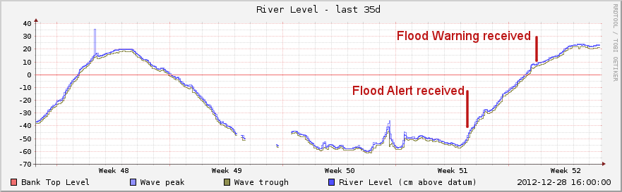
The Loddon Drive area of Wargrave flooded in late November 2012 and again in late December. This graph shows the level of the Thames from 24th November to 28th December. The red horizontal line is roughly at the level where water starts flowing out of the Thames across the land above Shiplake weir. The vertical scale is in centimetres.
Temperatures
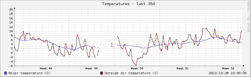
Air and river temperatures 24th November to 28th December 2012:
Going down again
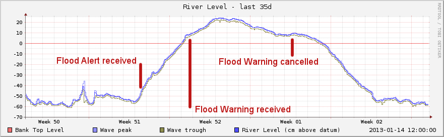
This graph shows the whole event. Loddon Drive became impassable to ordinary cars a day or two after the Flood Alert - well before the Flood Warning, so take future alerts seriously!
The low point under the bridge near Wargrave Station was passable with care by Sunday 6th Jan,
after almost 2 weeks of flooding. The Thames reached its normal level again on Wednesday 9th January 2013.