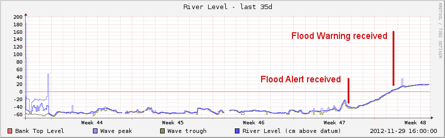
Flooding Nov-Dec 2012
The Loddon Drive area of Wargrave flooded in late November 2012. The graphs here show the level of the Thames in the early stages of this event.
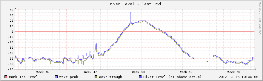
The red horizontal line is roughly at the level where water starts flowing out of the Thames across the land above Shiplake weir. The vertical scale is in centimetres.
25th Oct to 29th Nov:
The week of rising levels in more detail, 22-29 Nov:
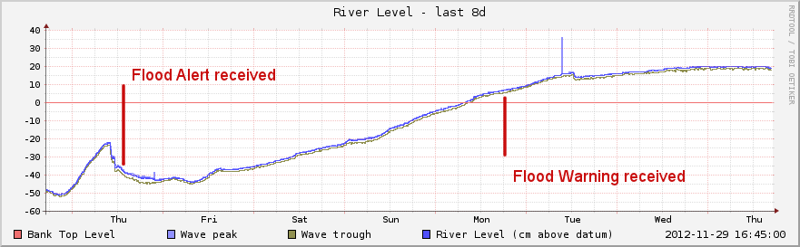
It was still possible to drive under the railway bridge on Loddon Drive on Sunday 25th Nov, but the water was already deep enough to damage cars with low ground clearance. By Tuesday 27th it was necessary to use thigh-waders on that section of road.
On the evening of Tuesday 27th, water got into the gas mains and central heating units began to cut out. On Wednesday, National Grid disconnected the gas supply with the assistance of the Fire & Rescue Service water-rescue unit.
25th Nov - 3rd Dec 2012:
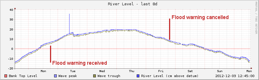
By Sunday 2nd December the water had dropped so that most of the road was clear. There was still enough water under the railway bridge to damage most ordinary cars, but foot access was not a problem.
Gas supply was restored to most properties on 4th and 5th December.
Here is the whole event, 12th Nov - 15th Dec 2012:
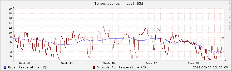
Temperatures
Air and river temperatures 29th October - 3rd December 2012: