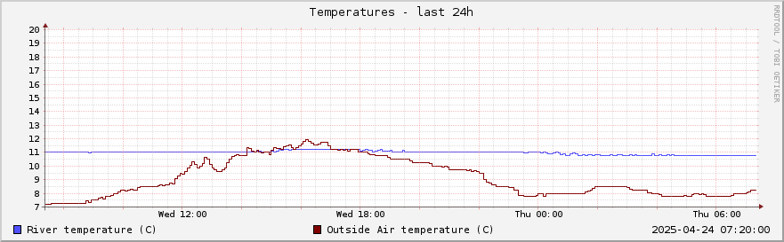
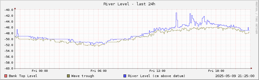
River Thames data sampled above Shiplake Lock
River level and temperature is measured about 350m above (west of) Shiplake Lock - roughly 100m above the weir. The level datum is arbitrary, and a line is shown on the graph at approximately the level of the southern river bank. Note that floods in this area usually come from rising groundwater or from the River Loddon rather than from the Thames.
Click on the graphs for historical data.